An OpenStreetMapper goes Wiki: my experience of the Wikimania 2026!
You know me, I’m usually more of a map person. I’ve been attending the State of the Map conferences for years, but I also dabble in Wikimedia projects: sharing subway or cable‑car photos on Wikimedia Commons and fixing (rare) typos in French Wikipedia articles.


Simon Delahaye - CC BY-SA 4.0
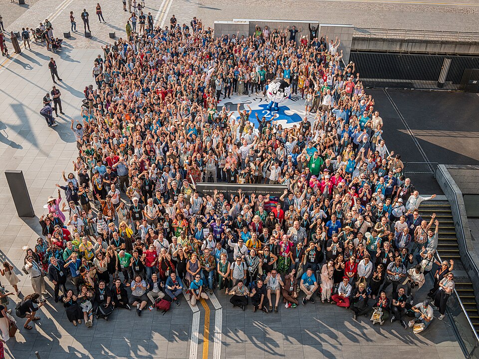
For the first time, Wikimania 2026, the global gathering of the Wikimedia community, took place in Paris from 21–25 July. With around 1200 participants, it was my debut at a Wiki worldwide event, and I discovered how this conference differs from OSM meet‑ups. Let’s dive into my experience and takeaways.
Opening & closing ceremonies: a message of hope

Mateusz Kopeć - CC BY-SA 4.0
The opening and closing talks were truly uplifting. In a world that feels increasingly fraught (climate change, AI anxieties, fake news, rising hostility…), the speakers reminded us that the Wikimedia community has stood together for 25 years, turning open knowledge into a shared refuge. Their words were clear: you are not alone. This unity is built on liberty, equity, integrity, and keeps us resilient. The performance by WikiOrchestra and WikiChoir was powerful: the music, as a universal language, brought people from all over the world, singing together.
Team Challenges: a new hackathon format
For the first time, the organizing team tried a more prepared hackathon model: Team Challenges. Many teams spent a bit of time sharpening ideas and receiving coaching before the event, then benefited from hands‑on mentorship on site while bringing together people with diverse backgrounds and skill sets. A strong emphasis was placed on making teams as varied as possible: on‑site and remote, local and international, gender and skills diversity.
I joined the Win the Kiwi team, focused on gamifying knowledge. We worked on improving the geolocation of pictures from Wikimedia Commons. Our coach, Raphaële, guided us throughout. Her steady feedback kept the team moving forward.
We sketched a simple web app that turns a tedious task into a playful scavenger hunt: you pick a local landmark (like Cité des Sciences), browse a list of non‑geotagged pictures nearby and spot where an image was taken. You go to the exact capture position and click “I’m there”, so your GPS location is saved as the picture’s coordinates. You earn points and badges along the way, turning tedious edits into a mini‑game.

Sketch for the UI
We delivered a proof of concept and UX sketches that could evolve into a more complete game later on. The 1½‑day on‑site window felt tight for deeper development, but the experience was interesting and enriching.
Hackathon: the Classic Edition ™️
Like every past Wikimania edition, a classic hackathon was organised. It was a good opportunity to bring together talented people and newcomers from around the world. As someone new to the Wiki community’s development tools, it was exciting to learn from all these people.
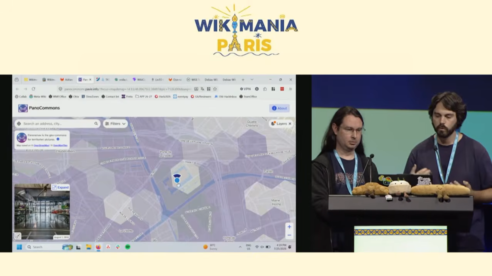
I teamed up with Seb35 on PanoCommons, a new bridge that pulls street‑level images from Wikimedia Commons to make them compatible with Panoramax. Beyond the technical challenge, the idea is to make these pictures easier to access for both OpenStreetMap contributors (via editors like iD) and GIS professionals.

The nuts and bolts were trickier than they look: Wikimedia Commons data is a mishmash of categories (they told me it’s chaotic by design ™️) with only a basic geolocation support. The data exports are split into many tables with a mix of formats, and our data ingestion pipeline had to wrestle with quirks like broken UTF‑8 strings. Seb handled server‑side compatibility on Wikimedia’s infrastructure, while I dove into data cleansing and category filtering.
Bright‑eye conversations helped us, shout out to Julie (from April association) and the Canadian folk working on the archeological site geolocated imagery (I can’t recall your name, feel free to reach out!).
Finally, we wrapped all this teamwork in a short demo for the main conference room, inviting the audience: try the tool, and you’re welcome to help us make this project successful!
The OSM & Panoramax booth
On Friday we set up the OpenStreetMap France & Panoramax booth with Christian. It was a chance to showcase activities from both the OSM national community and the Panoramax initiative, which offer complementary approaches for open‑geo software. Compared to generic public‑event booths, this felt like a playground for knowledge sharing. With a worldwide crowd already attuned to the open‑source & open‑knowledge cause, discussions about map topics were very pleasant. And an opportunity to put names on pseudonyms or emails (hi Daniele!).

Habib M’henni - CC BY-SA 4.0
The community and general feel
What struck me most was the sheer diversity of voices at Wikimania, far beyond what I’d seen in an OSM gathering. People from every background came with their own stories and perspectives, yet they all rallied around one shared mission: making open knowledge truly universal. Special mention to the organizing team for focusing on a safe‑space for all participants. Generally, people cared for each other: introducing newcomers, bringing coffee when needed, or ensuring lost little Koala plushies found their owners! 🐨

Lucas Werkmeister - CC BY 4.0
And who could forget the mascots? Local groups carried their own plushies avatars, sparking a “Cuteness Committee” so they could talk with one another. A mascot doctor took care of some weary plushies, and on-the-fly crochet workshop were organised. Finally, an exceptional guest star: Baby Globe! The 25-years anniversary mascot was roaming the venue, taking pictures with amazed participants.

PanierAvide - CC BY 4.0
A final word
As someone who usually spends most of my time in the OpenStreetMap community and only occasionally dips into Wikimedia projects, discovering the depth and passion of the Wikimedia world was both unexpected and exhilarating. The community’s scale, warmth, and unwavering commitment to free knowledge left a lasting impression.

Fawaz.tairou - CC BY-SA 4.0
A big thank you to everyone who made this happen: the organizing committee, all volunteers and sponsors. Next stop: Santiago in Chile!
And if maps spark your curiosity, don’t miss the State of the Map in Paris from 28–30 August. It’s a great chance to reconnect with fellow cartographers, explore new tools, and share what we’ve learned on this journey. Everyone’s welcomed, especially the Wiki community!